California Geography and Topography
“If California lies beyond those mountains we shall never be able to reach it,” wrote John
Bidwell, leader of the first overland emigrant train, in his journal on October 29, 1841. But on
the next day he set down: “We had gone about three miles this morning, when lo! to our great
delight we beheld a wide valley .... Rivers evidently meandered through it, for timber was seen
in long extended lines as far as the eye could reach.” The day after, he continued: “Joyful sight
to us poor, famished wretches! Hundreds of antelope in view! Elk tracks, thousands! The valley
of the river was very fertile, and the young, tender grass covered it like a field of wheat in May.”
Thousands of late emigrants who struggled to the crest of the Sierra Nevada, which towered
like a massive wall along the State's eastern border, were equally overjoyed at their first glimpse
of El Dorado. As they stood at the summit, the dry wilderness of the Great Basin lay behind
them.
To north and south rose the rock-ribbed flanks of the huge Sierra Nevada, about 385 miles
long and with an average width of about 80 miles. Westward, they looked toward the Great
Valley of California, a vast elliptical bowl averaging 50 miles in width and more than 400 miles
long-larger in area than Vermont and New Hampshire combined.
Beyond the valley stood the dim blue peaks of the Coast Range, skirting the ocean and
paralleled to the Sierra in chains from 20 to 40 miles wide and 500 miles long. Far to the north,
beyond their vision, the rugged Cascade Range and Klamath Mountains closed in on the
Valley's northern rim. And far to the south, the Tehachapi Mountains thrust their barrier from
east to west across its southern end.
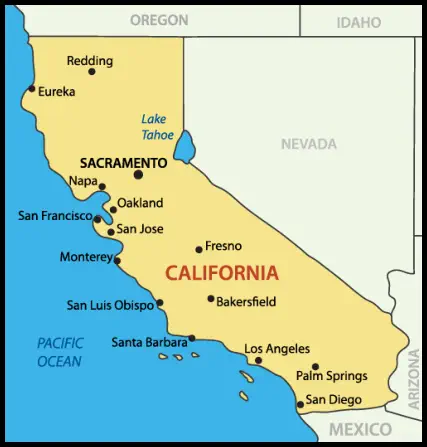
California, with a total land area of 158,706 square miles, is the nation's third largest State.
In the language of the geographer, its latitude extends from 32 degrees 30' to 40 degrees N.,
and its longitude from 114 degrees to 124 degrees 20' W. Its medial line, from Oregon to the
Mexican border, is 780 miles long. Its width varies from 150 to 350 miles. Its coastline is
approximately 1,200 miles-somewhat less than one-tenth of the total coastline of the United
States. So pronounced is the eastward curve of the State's southern coast that San Diego lies
farther east than Reno in Nevada, although Eureka, a northern port, is the most westward city
in the United States. On the east, the State is bordered by Nevada and by the Colorado River,
which separates its southeastern corner from Arizona.
Beyond each end of the mountain-walled Great Valley, which is California's most distinctive
topographic feature, the terrain is broken and rugged. Northward lie the Siskiyou Mountains, a
natural barrier between California and Oregon. In the northwest, wild timbered slopes reach
to the Pacific; in the northeast, mountain spurs hem in barren lava-bed plateaus.
South of the Techachapi's dividing line lies southern California, comprising one-third of
the State's area. Here the complex network of the Sierra Madre, the San Bernardino, and other
ranges separate the so-called Valley of Southern California, a broad strip of broken country
near the coast, from the arid wastes of the Mojave and Colorado deserts. From Point
Concepcion, where the Coast Range breaks into numerous ridges and the coast swings in
sharply to the east, the Valley of Southern California, including the V-shaped costal plain of the
Los Angeles Basin, stretches southward to the Mexican border.
These chief geographical districts-the Sierra and Coast Range regions and the Central
(Sacramento-San Joaquin) Valley in the north, the coastal lowlands, the mountains, and the
desert country in the south-present startling physiographic contrasts and extremes, from active
volcanoes to glaciers, from arctic flora on mountain tops to cotton plantations below sea level.
From the peak of Mount Whitney, the highest point in the United States, it is
about 60 miles to Death Valley, the continent's lowest area. Human activities have ranged from
fur-trapping in the snows of the Klamath region to prospecting for minerals in the furnace-
like heat of the southeastern deserts.
California's contour is marked by lofty mountain peaks towering above precipitous gorges
and canyons. Of the 41 peaks that exceed 10,000 feet in height, the tallest is Mount Whitney
(14,496 alt.) in the southern Sierra. The Sierra's abrupt eastern slope has one of the steepest
general gradients on the North American continent. Over a 160-mile stretch, the lowest pass is
at an altitude of 9,000 feet, while Kearsage, at one time the most frequently used pack horse
pass on this stretch, is 12,050 feet. In this area, the peaks range from 13,000 to 14,000 feet in
height. Although there is a gradual decline in altitude to the north, other isolated peaks of the
Sierra rise above 14,000 feet. Northward, the western slopes are gashed by river canyons
sometimes half a mile deep.
The Sierra's sculptured splendor is in part the work of glaciers that carved deep valleys,
expanses of polished rock, and towering granite walls; over these, great waterfalls roar, and
glacial lakes and meadows lie below. Most beautiful of the valleys is Yosemite, in the midsection
of the Sierra; loveliest of the lakes is Tahoe (6,225 alt.), cupped between the main Sierra and the
basin ranges at the angle of the Nevada-California boundary. A few glaciers still survive on the
highest summits, the finest of them a group of five supported by Mount Shasta (14,161 alt.).
Dominating the northern end of the Sacramento Valley is Mount Shasta, the most striking of
the many extinct or dormant volcanoes in the northern California mountains. Lassen Peak
(10,435 alt.), 85 mile southeast of Mount Shasta, is a mildly active volcano. Although traces of
volcanic action are most abundant in the State's northeastern sector, where lava beds spread
over vast tracts, there are also extinct or dormant volcanoes in Owens Valley and the Mojave
Desert, and numerous hot springs in the Coast Range.
The Coast Range, more complex than the Sierra, includes numerous indistinct chains from
2,000 to 7,000 feet high. Each chain is broken down into forested spurs and ridges enclosing
small pleasant valleys and plains drained by rapid streams.
The Santa Ynez, San Bernardino, and San Gabriel mountains bound the lowland of southern
California on the north and northeast, and subdivide it into more or less distinct valleys or
basins. Farther south, the coastal lowland is bounded by the Santa Ana and San Jacinto ranges,
an elevation that extends into Mexico.
The southern California ranges are marked by the lofty peaks (more than 10,000 feet high)
of San Bernardino, San Jacinto, and San Antonio, and by the well-defined passes of Soledad,
Cajon, and San Gorgonio.
Among the mountain-walled valleys, between the southern end of the Sierra and the border
of Nevada, is the long and narrow Owens Lake, which is bordered by granite walls. About 40
miles east of dry Owens Lake, along the California-Nevada border, lies Death Valley, its lowest
point 276 feet below sea level. It stretches between the sheer rocky walls of the Panamint
Range on the east and the
Amargosa Range on the west-130 miles long and from 6 to 14 miles wide-a region of stark
simplicity, majestic silence, and spectacular desolation.
South of Death Valley are spread the Mojave and Colorado deserts. The Mojave is an
expanse of ancient dried lake bottoms, short rugged ranges, and immense sandy valleys. Parts of
the Colorado Desert lie below sea level-250 feet below at its lowest point. In its southern end is
the fertile Imperial Valley, largely reclaimed from the desert for agricultural use by irrigation.
The Salton Sea was formed when the Colorado River broke its banks, in 1905, and flooded an
ancient lake bottom.
In addition to the Great Valley in the north and coastal district (including the rich Los
Angeles Basin and Santa Clara and San Fernando Valleys) in the south, cultivated lowlands
occur elsewhere in the State. Below San Francisco Bay stretches another Santa Clara Valley; and
southeast of Monterey Bay, between the Santa Lucia and Gabilan ranges, lies the long Salinas
Valley. North of San Francisco in Sonoma, Mendocino, and Humboldt counties are similar
areas. The northeast corner of the State, hemmed in by steep ranges, is suitable for cattle raising
and restricted agriculture despite its lava beds and sagebrush.
In the whole 400-mile length of the Great Valley, there is only one break in the mountain
walls through which the waters of the interior can escape to the sea. Behind the Golden Gate at
San Francisco, cutting across the full width of the Coast Range, is a great gap through which
passes almost the entire drainage of the Great Valley. Into Suisun Bay pour the waters of the
Sacramento and San Joaquin rivers; they empty through Carquinez Strait into San Pablo Bay
and San Francisco Bay, and through the Golden Gate into the Pacific Ocean.
The scantily forested eastern flanks of the Coast Range contribute no stream lasting enough
to reach either the Sacramento or the San Joaquin in the dry season. But down the western
slopes of the Sierra, tributaries pour through precipitous canyons to the great rivers at each end
of the valley. Fed by Mount Shasta's melting snows, the Sacramento, California's largest river, is
joined by the Pit, McCloud, Feather, Indian, Yuba, and American rivers. The Sacramento flows
southward 350 miles to its confluence with the San Joaquin in the Delta region. The
Sacramento's lower course is through a marshy plain partly inundated yearly. The San Joaquin,
whose valley comprises more than three-fifths of the central basin, flows northward from its
headwaters in the mountains of Fresno County. Into it drain the waters of the Fresno, Merced,
Tuolumne, Stanislaus, Calaveras, Mokelumne, and Consumnes rivers, together with many
smaller streams.
The seaward slopes of the Coast Range are drained by the Klamath (joined by the Scott and
Trinity), Mad, Eel, and Russian rivers north of San Francisco, and south of it by the Salinas,
Santa Maria, Santa Ynez, Santa Clara and the secondary rivers, many of them intermittently
dry. Southern California's so-called rivers, the Ventura, Los Angeles, San Gabriel, Santa
AnaLuis Rey, Santa Margarita, and San Diego-are for the most part dry creek beds except
during spring floods.
A peculiarity of the State's drainage system is its many river “sinks” where the waters either
dry up from evaporation or, like the Amargosa River in Death Valley, disappear beneath the
surface. Through Modoc and Lassen counties, in the far northeast, stretches a chain of alkaline
“Lakes”-Goose, Upper and Middle, and Honey lakes. They are all without drainage to the sea,
and the spring run-off rapidly evaporates. In the Central Valley, south of the area drained by
the San Joaquin, the Kings, Kaweah, and Kern rivers, fed by the melting snows of the high
Sierra, formerly emptied into shallow marsh-girt lakes. But with the impounding of water for
irrigation, these lakes have dried up and the old lake beds have become farm lands. The Mojave
Desert, in whose sandy wastes the Mojave River is swallowed up, is dotted with glistening
alkaline-encrusted dry lake beds. In Riverside, San Diego and Imperial counties, many creeks
(so-called rivers whose beds are normally dry) run toward the desert sink of the Salton Sea
region.
California has two magnificent natural harbors, San Francisco and Bay San Diego Bay, both
landlocked; and one great artificially built harbor, the port of Los Angeles. San Francisco Bay,
entered through the Golden Gate, is among the world's finest; here, besides the port of San
Francisco itself, are those of Oakland, Alameda, and Richmond. San Diego Bay, safe at all
seasons, is sheltered from ocean winds by Point Loma, a promontory seven miles in length.
The Los Angeles harbor, fronting on open San Pedro Bay, 20 miles from the city, is protected
by a breakwater. California's best minor harbors are the Monterey and Santa Cruz on
Monterey Bay, and the Eureka on Humboldt Bay, some 280 miles north of San Francisco.
There are two groups of islands off the California coast. The Santa Barbara Islands, nine in
number, lie between Point Concepcion and San Diego, 20 to 60 miles from the mainland.
From San Miguel Island in the north to San Clemente Island in the south, they are scattered
over a distance of 155 miles. The best known island of the group is the rugged Santa Catalina,
25 miles long with an average width of four miles, which stands 20 miles south of San Pedro.
The Farallones, a group of six small rocky islands, lie about 28 miles west of the entrance to San
Francisco Bay.
CLIMATE
The first American writer to describe California's natural features refrained from the
rhapsody which has characterized most of the subsequent discussion of the State's far-famed
weather. “The climate of California,170> wrote Captain William Shaler, “generally is dry and
temperate, and remarkably healthy; on the western coast the sky is generally obscured by fogs
and haze, but on the opposite side it is constantly clear; not a cloud is to be seen, night or day.
The northwest winds blow very strong eight months in the year, on the western coast, with
very little interruption; the land breezes at that time are hardly perceptible; but in the winter
months they are stronger and regular. In the months of January, February, and March there are
at times very high gales from the southeast, which render most of the bays and harbours on the
coast unsafe at that season.”
California's climate is characterized by certain peculiar features. The temperature of the
entire Pacific Coast is milder and more uniform than that of regions in corresponding latitudes
east of the mountains; the year divides, in general, into two season-wet and dry-instead of into
the usual four seasons; and where extreme summer heat occurs, its discomfort is lessened by the
dryness of the air.
Despite these general characteristics, the State is a place of many climates, due to distance
from the ocean, situation in reference to mountains, and, above all, altitude. Thus, there are
sharp climatic contrasts within a single limited area. One may go sleighing within sight of
blossoming orchards, or view snow-clad peaks while bathing in the sea. A winter traveler in the
high Sierras will be reminded of the Alps, while anyone venturing into the scorching inland
valleys in midsummer will conclude that whoever labeled California “semitropical” was a
master of understatement.
The term, however, is applied with good reason to the strip of land between the coastal
mountains and the ocean. For those who have never visited this area, the most restrained
account of its climate is likely to seem hyperbole. The year-round weather is more equable than
that of any other part of the United States; and from San Francisco southward to Monterey,
the difference between the average summer and winter temperatures is seldom more than 10
degrees. In this coastal region, frost heavy enough to halt the greening of the hills under winter
rains is as rare as thunder and lightning; and always some flowers are in bloom. Sea breezes and
fogs tend to stabilize the temperature without extremes of heat or cold.
The annual mean temperature of San Francisco is 56 degrees; the summer mean is less than
60 degrees, the winter less than 50 degrees, and the lowest recorded temperature 27 degrees. In
San Diego, the winter mean temperature is 56 degrees, the summer 70 degrees. In Monterey,
January and August mean temperatures differ from 10 degrees to 14 degrees; in Los Angeles,
14 degrees to 16 degrees. Because of the California current and the marine air from the Pacific
anticyclone, summer in San Francisco is actually cooler than fall. These same factors induce
fogs, night and morning, in the region and all along the California coast during the greater part
of the summer. So dense and persistent are these coastal fogs that great areas south of San
Francisco devoted to truck gardening require no other moisture during the summer months.
The Coast redwood, as well as the plants which grow beneath it, obtains water by the fog that
condenses on its foliage.
In the southern part of the Central Valley, temperatures are often very high. Although the
annual mean temperature of the inland is 64 degrees, in Fresno and Bakersfield, the mercury
occasionally soars above 110 degrees. The desert temperatures are still higher, the summer
mean in Fort Yuma being 92 degrees. In Death Valley, the average daily minimum for July, the
hottest month, is 87.6 degrees.
Annual rainfall in the State varies from about 80 inches at Crescent City in the extreme
north to about 10 inches at San Diego in the extreme south. At San Francisco, the annual
average is about 22 inches; at Los Angeles, 16 inches. The northern half of the Sierra and the
northwest counties are covered by a heavy rain belt. In the high mountains, precipitation,
almost entirely in the form of snow, provides most of the run-off which supplies water for the
cities and for irrigation. In the high Sierra, the average annual snowfall is from 300 to 400
inches. At Tamarack in Alpine County, snowfall during the winter of 1906-7 was 844 inches,
the greatest ever recorded for a single season anywhere in the United States. The belt of heavy
rain shades off a region of lighter rainfall which covers all the rest of the State except Inyo,
Kern, San Bernardino, and Imperial Counties, and the eastern portion of Riverside County.
The limits of this third region may, in dry years, include all of the State below Fresno and the
entire Central Valley.
In general, rains occur in California only in the months from October to May. Even during
this rainy season, the valley districts usually have no more than 25 to 35 rainy days.
Throughout the rest of the year, excursions may be planned everywhere, except in some parts
of the mountains, with considerable confidence that no rain will dampen the occasion.
GEOLOGY AND PALEONTOLOGY
Every major division of geologic time is represented in California by marine sediments, and
many of them by continental deposits as well. As the Pacific Ocean on the west and ancient
Great Basin Sea on the east alternately encroached on the California region, each supplied that
part of the record which the other omitted. In formations of the last two periods, the Tertiary
and the Quaternary, California is particularly rich.
Structurally, the Sierra Nevada is a single colossal block of earth's crust, lifted along its
eastern edge to a height of more than 11,000 feet above the adjoining block, and gently tilted
westward. The oldest known rocks making up these mountains are intrusions of molten rock
(magma) and limestones, cherts, shales, and sandstones, all sedimentary, and nearly all changed
into their metamorphic equivalents in the process of mountain building. These older
sedimentary rocks were deposited in ancient seas of shifting extent and depth. During the
second half of the Paleozoic and the first two periods of the Mesozoic era, they covered first
one part, then another, of the Pacific Coast. Toward the close of the Jurassic period, the lands
that were eventually to become the ancestral Sierra Nevada, the Cascades, and the Klamath
mountains began to emerge from the sea.
During the Cretaceous period, the Sierra's whole block tilted westward. This process of
tilting and folding wrenched open leaves of slates, once shales; heated mineral-bearing
solutions escaped from the magma that was cooling and solidifying below, and filled the slate
openings with gold-bearing quartz. The Eocene epoch of the Tertiary period was
comparatively quiet. The Sierra slowly underwent additional elevations and subsidences
accompanied by active erosion of the surface rocks. Meanwhile, the rivers were cutting their
channels down the western slope and carrying the products of erosion to the inland sea. There
was further release of gold from the bedrock, and the formation of rich placers. In the
Oligocene epoch following, there was volcanic activity, and the Sierra gold-bearing stream
channels were dammed and filled with rhyolite ash.
Volcanic activity continued during the Miocene age, and, in addition to lava, there were
extensive mud flows and tuffs. In the Pliocene epoch, the volcanos were far less active; in the
Pleistocene, the volcanic cover was removed in part by erosion. The veins and buried stream
channels were cut into, and gold-bearing gravels were washed from their ancient channels and
redistributed along new streams. This is the origin of so-called free gold. The Sierra had been
greatly worn down in late Tertiary times, but the Pleistocene epoch of the Quaternary period
was an era of re-elevation. There was much faulting, and a new period of volcanic activity
began.
In the early Tertiary period, the Sierra slopes were luxuriant with vegetation, but toward
the end of that period the climate became much cooler. The slopes and summits were encased
in thick ice and snow, which kept them captive. The glacial periods of the Pleistocene were
relieved by intervals during which the ice fields retreated toward the crests, yielding to climates
even milder than that of California today.
But when the ice of the last glacial age had finally retreated (traces of this epoch still linger
in various glaciers such as those on Shasta), the Sierra crest stood stripped of vegetation and
soil, exposing those bare expanses of whitish granites and schists that now give it its dazzling
beauty. Yosemite and other extraordinary Sierra valleys and canyons are also glacial legacies, as
are the numerous lakes in the high Sierra. Tahoe, lovely lake and the deepest in the United
States, was made partially by glaciation and partly by faulting, erosion, and volcanic damming.
The volcanic activity of Miocene times was especially great in the Cascade Range, where a
number of volcanic peaks rose in a comparatively short time. Mount Shasta was one; the still
active Mount Lassen was another; the volcanic range extends north into Oregon and
Washington. Eastward from the range extends one of the largest lava fields in the world,
covering 200,000 square miles, to depths from 200 to 2,000 feet. This lava plateau, generally
decomposed on the surface, stretches beyond California into Oregon and across into Idaho and
Wyoming. The lava did not, for the most part, erupt through typical volcanic vents, but
flooded up through great cracks or fissures. The Pit River, flowing through the Cascades, has
cut deep into the series of volcanic rocks (andesites) some 7,500 feet in thickness, and the thin
but widespread basalts. Because of the depth of this covering, the pre-Miocene history of the
region is uncertain.
The oldest of the accessible formations of the Klamath Mountains are pre-Cambrian
metamorphic rocks, including schists, quartzites, and crystalline limestones-the last named
consisting partly of sedimentary, partly of igneous rocks, both metamorphoses. The first two
periods of the Mesozoic are represented by smaller proportions of sedimentary, partly of
igneous rocks, both metamorphosed. The first two periods of the Mesozoic are represented by
smaller proportions of sedimentary rocks, which are covered by remnants of once extensive
beds of sandstones, shales, and conglomerates of the Cretaceous period. There were also
periods when volcanoes were active, especially the early Devonian period and the greater part
of the Mesozoic era. The mass had been uplifted during the Jurassic period, but erosion and
subsidence brought the ancestral Klamath Mountains to below sea level in the Cretaceous
period. This oscillation continued more or less quietly, except for an outburst of great volcanic
activity in the middle of the Miocene. The most recent re-elevation, like that of the Sierra, was
at the beginning of the Quaternary period. At approximately the same time, gold-bearing
gravels were carried down along the sides of many canyons by erosion.
There are no Paleozoic (old life) rocks in the northern Coast Range. But crystalline
limestone and schist, probably of this age, are found in the Santa Cruz, Gabilan, and Santa
Lucia ranges. Of the next era, the Mesozoic, Triassic period remains are lacking. But from the
Jurassic come most of that complex series of Coast Range rocks known as the Franciscan.
These are sedimentary rocks of several types: conglomerate, sandstone, shale, variegated chert,
and (rarely) limestone. With them is embedded a great series of volcanic and plutonic rocks of
the same age.
Cretaceous rocks in the Coast Range are abundant. They make up considerable parts of the
Santa Lucia, the Temblor, and the Diablo ranges, and they become even more widespread
north of San Francisco. The rocks consist of chiefly of shale, siltstone and sandstone, with
some small streaks of coal, and-near Coalinga-shale, which is the source of the oil in overlying
Tertiary beds. The Cretaceous sea covered considerable parts of what is now the north Coast
Range, but the region that now comprises the Santa Lucia Range and the Salinas Valley was
relatively higher than at present, and formed Salinia, a long narrow peninsula running out to
the northwest. The Eocene strata are relatively uncommon except in the eastern foothills near
Coalinga and in the Mount Diablo region. The rocks are similar to those of the Cretaceous.
There are considerable beds of coal, but the latter is of poor quality. Salinia had become an
island, and there was a similar island whose axis ran along what are now the Gabilan and
Mount Hamilton ranges northwest to Marin County.
The Oligocene formations in the Coast Range are chiefly of red sandstone; there are also
certain organic shales, which seem to be the source rocks for the oil of Kettleman Hills. The
seas had become less widespread. Salinia extended farther north and west, but the San Joaquin
Valley still formed an arm of the sea into which drained the rivers of Mohavia-a name given to
the region now covered by the Mojave Desert, Death Valley, and the Owens River Valley. In the
early Miocene, there was much volcanic activity in the Coast Range, and this ultimately cut off
the sedimentary deposits from Mohavia and prevented their reaching the sea. There followed
in the late Miocene another period of widespread shallow seas and many coastal islands. Much
organic siliceous shale was laid down, and this is the source of the oil in the Santa Barbara and
Ventura coast region, as well as elsewhere. Of Piocene origin are calcareous and feldspathic
sandstones and thick beds of brown and blue sandy clay. As elsewhere in California, the
climate became cooler. There was still a series of islands and peninsulas along the entire coast.
In the Pleistocene epoch, most of the old interior seas and bays disappeared. This was a
period of violent deformation of structure, with foldings and bendings of the strata and a series
of faults. Of these latter, the San Andreas fault, which was responsible for the earthquake of
1906, extends from Tomales 40 miles north of San Francisco, to the Mojave Desert, 600 miles
southeast. In contrast to the more common type of vertical movement, it has a horizontal drift.
The extent of its movement during Tertiary times was at least 700 feet, and according to some
estimates, as much as 10 or 20 miles. The Hayward fault, which runs sub-parallel to the San
Andreas across San Francisco Bay and through Berkeley, is also important; and the Coast
Range is cut by several smaller faults.
The Great Valley is an immense trough formed late in the Jurassic period, when the
mountain ranges enclosing it began to rise from the water. Unlike most valleys in the United
States, which were cut by streams, it came into being through the sinking of the earth's crust.
From that time on, it remained an inland basin. For long periods it was flooded with salt water,
as the sea flowed in through gaps in its intermittently rising barriers. The upward thrust of the
Coast Range in the middle of the Tertiary period made it a nearly landlocked and shallow
inland sea. Finally, in early Pleistocene times, the streams of the Sierra and the Coast Range,
steadily carrying down their loads of sediment, caused a recession of the sea and laid down the
flat valley floor. Although the valley is probably still sinking, it has filled with alluvium as fast
as it has sunk. In some places, drillings to depths of more than 3,000 feet fail to reveal bedrock.
The Transverse Ranges, comprising the San Bernardino, San Gabriel, Santa Monica, Santa
Inez, and Santa Susana mountains, have a general east-west trend, but differ only slightly in
their geology from the chains of the Coast Range. Some of their Tertiary sedimentary rocks are
more than 30,000 feet thick, exceeding in thickness any other such rocks in North America.
They are remarkably rich in fossils.
Extending southeast of the Los Angeles Basin to a point beyond the Mexican border, the
Peninsular Ranges include the San Jacinto, Santa Ana, Santa Rosa, and Coyote mountains,
with plateaus and
valleys in between. Their geology has been but little studied, but they seem to belong to the
fault-block type of mountains. While the faults are branches of the San Andreas, their general
geology is rather like that of the Sierra, the dominating rocks being granitic.
The Great Basin comprises all that part of California lying southeast of the Sierra and east
of the Peninsular Ranges, including the Colorado Desert, the Mojave Desert, and the Basin
Ranges. Except for the Imperial Valley and some smaller areas under irrigation, the section is
today a complete desert. The Colorado Desert, in part 245 feet below sea level, is a depressed
block between active branches of the alluvium-covered San Andreas fault in the Peninsular
Ranges and the Mojave Desert to the north and east. The Mojave Desert region has isolated
mountain ranges rising abruptly from desert plains.
Farther north the Basin Ranges, of typical fault-block structure, run roughly parallel from
north to south and are separated by deep basins or troughs. Death Valley, the most famous of
the basins, is the bed of a lake of Pleistocene times and shows distinct sets of shore lines. The
Great Basin had a number of such lakes in recent geologic time, although the region as a whole
has been a land area since Cretaceous times. In the Panamint and Amargosa Ranges, which
fence in Death Valley on the east and west, are formations from as far back as the Paleozoic era,
but the valley, as such, is recent.
The Mojave Desert's many short mountain ranges of various trends are largely of ancient
volcanic and metamorphosed Tertiary rocks. The rest of the Mojave is an expanse of great
sandy valleys and of dry lakes holding deposits of dead seas-salt, gypsum, soda, and borax. The
last named was formed when the red-hot lava streams flowed into the saline lakes. The
Colorado Desert is underlaid with Tertiary volcanic flows and coarse conglomerates, above
which lie Quaternary fresh-water silts and sandstones.
With the rise of the mountains to the north and west in the early Miocene epoch, the sea
that covered them was cut off and inland drainage systems were created. Rainfall decreased and
the region slowly dried up. However, lakes of considerable extent have existed in the basin of
the Colorado River within the period of the occupation of the country by the Indians, whose
old camps may still be found on the margins of what are now salt flats.
A number of regions in California, particularly in the Coast Range and the Los Angeles
Basin, are rich in fossils. Numerous fossil radiolaria found in the Franciscan cherts show their
marine origin, and the north Coast Ranges have yielded fossil ferns, cyads, and conifers, as well
as several kinds of mollusks and smaller marine organisms of the Cretaceous period. The types
of marine organism found in the Eocene rocks indicate a much warmer surface water than
exists on the California coast at present, and consequently a warmer climate.
From the Sespe beds between Los Angeles and Ventura have come bones of a variety of
mammals of Oligocene times: the rhinoceros, the oreodont, the miohippus, the camelid,
primitive carnivores, rodents, and insectivores. At a number of places the remains of primitive
horses, peccaries, and camels have been found in Miocene formations. In the Pliocene strata
there are primitive horses close in form to the modern horse.
The best-known paleontological area in California, and one of the riches in the world, is La
Brea Pits in Los Angeles County.
Since Tertiary times the quaking and sticky area of the La Brea asphalt beds has been a death
trap for unwary animals. Beneath it have been preserved the skeletons of a prehistoric
menagerie, including the imperial elephants, largest of all land mammals, whose domain
extended from eastern Nebraska to Mexico City, hideous great ground sloths and little ground
sloths, sabre-tooth tigers, giant wolves, camels, horses, llamas, wide-front bison, and numerous
smaller species such as turtles, snakes, beetles, and birds.
Well-preserved forms of vegetation, which show the evolution of plant life, have also been
unearthed here. Noteworthy among these is a complete eight-foot cypress of the McNab
species, which was discovered standing upright, buttressed by bones. This species is now found
only rarely on the dry hills and flats of the Coast Range in northern California.
The Mojave and Death Valley Deserts of southern California have yielded fossils of the
Oligocene and Miocene epochs, deposited as long as 25,000,000 years ago. In a narrow canyon
near Barstow, where layers of breccia in dazzling colors were thrust up by an ancient volcanic
upheaval, scientists have discovered during the past twenty years the remains of three-toed
horses, several varieties of camels, antelope, and smaller animals, and an animal almost identical
with the desert coyote of today. The complete skeleton of an Ice Age elephant (terrabeladon),
similar to fossils discovered in the Gobi Desert, was found in 1938 near Saltdale, Kern County,
in the northern part of the Mojave Desert. Death Valley's Tertiary beds have yielded the
remains-including a skull three feet long-of a titanotherium, a large mammal that somewhat
resembled the rhinoceros, found in red sandstone formations of the Oligocene epoch near
Leadfield.
The fossils of Inyo County's “oldest muds in the world” are so abundant that, in geologist
G. D. Bailey's words, they “are hauled away by carloads to fill the museums of the East.” In
Fresno County, less rich paleontologically, submammmalian fossils have been found near
Coalinga, a Pliocene mastodon skull at the north end of the Kettleman Hills, and fossil
mastodon bones near Fresno. A rare find, uncovered in the Coast Range west of Fresno in
1937, was a fossil of eight vertebrae of a mesasaurus, a huge sea lizard of the upper Cretaceous
epoch. Kern County has yielded fossil animal bones of Tertiary and earlier ages and
exceptionally rich marine fossils of the mollusca phylum, among them some highly
ornamented forms showing a considerable degree of advancement in racial development.
The first dinosaur remains ever uncovered on the west coast of America were found in 1936
in the hills west of Patterson, Stanislaus County, by a high school student. The remains
consisted of the tail and one hind foot. In other mountain counties of northern California,
ancient caves-including Hawver's Cave on the North Fork of the American River in Eldorado
County, and Potter and Samwell Caves on the McCloud River in Shasta County-have proved
to be veritable storehouses of the bones of mammals swept in by river floods in the remote
past. Remains of the giant ground sloth (megalonyx) have turned up in the earth fan at the
entrance to Mercer's, or Murphy's Cave in Calaveras County.
PLANT AND ANIMAL LIFE
California's plant and animal life is as diverse as its environment. Its climate ranges from
subtropical to Arctic; its terrain ranges from the arid, below sea level deserts in the south to the
moist, forested mountains in the north, and from the ice Sierra ridges on the east to the foggy
coastal slopes on the west; all help the State to embrace its wide variety of flora and fauna.
All life zones of North America, except the tropical, are represented in the State, their
distribution depending not so much on latitude, as in most regions, as on altitude. California's
plant and animal life, virtually isolated from the rest of the continent, is frequently distinctive
and sometimes unique. While some species have migrated into the mountain slopes and coastal
fog belt of the north from Oregon, and into the semiarid deserts, plains, and mountains of the
south from Mexico, only a few eastern species have had the tenacity to cross the inhospitable
deserts of the Great Basin and scale the barrier of the Sierra. These have undergone striking
transformation in their migration.
Botanically, California is notable in particular for the unusual number of its annuals, both
species and individuals, and for its numerous rare species of the lily family. More evergreens,
especially the conifers, and fewer deciduous trees are found here than in most other states.
Notable also are the many species of trees surviving only in limited localities from past ages, of
which the best known are the Monterey pine and Monterey cypress and the two Sequoias (the
coast redwood and the “big tree”), representing a family extinct elsewhere since the Ice Age.
Still another distinctive feature is the chaparral-extensive pygmy forests of shrubs, stunted
trees, and associated herbaceous plants-which covers the hillsides of the Upper Sonoran zone in
dense thickets. It remains dormant throughout the hot dry summer, but becomes active with
the rains of late winter and early spring.
The eucalyptus and acacia of Australia, the pepper tree of Peru, and the palm tree of the
tropics flourish in both rural and urban areas; the eucalyptus (eucalyptus globulus) especially
has been so widely planted in groves and roadside lanes along the coast and in the Great Valley
as to seem like a native. The wild yellow mustard, covering orchard lands and hillsides in season
with a yellow-green tide, was planted by the earliest Spanish settlers, as was the wild radish.
The geranium and fuchsia both grow to extraordinary size in all the coast counties, where
there are no extremes of heat and cold. In a number of places in the Sierra foothills, Scotch
broom (cystisus scoparius) more than holds its own as an “escape” in the chaparral; and a
species of filarese (erodium macrophyllum), a valuable forage crop, has become widely
distributed.
The animals of the State are also distinctive, though less conspicuously so than the
vegetation. The birds as a whole tend to be grayer, paler, and of slighter build than their eastern
relatives. There are fewer species of snakes and more of lizards. Except for several species of
trout, few fresh-water fish are native to the State, although some interesting indigenous species
are found among the fauna of the tidal strip.
The steams were once abundantly supplied with sturgeon, but this magnificent fish has
practically disappeared save in the least accessible rivers of the State's northwest coast. The icy
lakes and streams of the Sierra favor many species of native and introduced trout. The former
include the rainbow trout (or steel head), the Tahoe trout, the golden, the cutthroat, and the
Dolly Varden. Salmon, migrating from the ocean to their upstream spawning beds, are found
in the northern coastal rivers in the spring. Dog salmon and quinnat salmon frequent coastal
waters, and the great king salmon enters the Bay of Monterey during the summer months.
Other deep-sea fishes are the black and white sea bass, the yellowtail, the sheepshead, the
“tonno,” albacore, the leaping and the yellowfin tuna, the bonito (the Sardo chilensis of the
Pacific), the voracious barracuda (Sphyraena barracuda), and the battling swordfish.
Marine life of every kind is prolific and variegated. The California lobster, though large, lacks
the huge pinchers of his eastern cousin. The pilchard or sardine (Sardina caerulea) is found in
such numbers during its run as to comprise 20 percent of the annual value of the State's
fisheries. Herds of sea lions roar from the rocks off San Francisco, and elsewhere the leopard
seal is occasionally seen. The abalone, most noted of California's shellfish, is a table delicacy
and its shell is of use in manufacture. Oysters are plentiful, but smaller than eastern varieties.
California is divided by biologists into six life zones; in each, altitude and climatic conditions
are roughly uniform throughout the zone. These are designated the Lower Sonoran, Upper
Sonoran, Transition, Canadian, Hudsonian, and Arctic zones. The first is the lowest in
altitude, and the warmest; the last is the highest and coldest.
The Lower Sonoran Zone. The Lower Sonoran includes the larger part of the Great Valley
from Red Bluff to Bakersfield, all of the great arid and desert regions southeast of the Sierra to
the Nevada and Arizona lines, and several long narrow strips extending from the Salinas Valley
south. The Upper Sonoran takes in all the foothill country of the Sierra Nevada, the lava
plateaus of Modoc and Lassen Counties, the western slopes of the Sacramento Valley, the inner
chains of the coast Range and Valleys from Mendocino County to San Francisco Bay, and all of
the coastal region south of San Francisco except the Santa Cruz Mountains and the higher
elevations of Santa Lucias. These latter belong to the Transition zone, which also includes all of
the coast country north of San Francisco, the heavily watered northeastern counties and a long
belt, between 2500 and 5000 feet high in the Sierra. The Canadian, Hudsonian, and Arctic
zones lie in the higher elevations of the Siskiyous, the Trinity Mountains, the Sierra, the San
Bernardino, and San Jacinto ranges.
It is possible to mention here only a few of the commoner or more characteristic
inhabitants of these biologic zones, as a brief indication of the extraordinary range and variety
of California's plant and animal life.
In the Colorado Desert section of the Lower Sonoran zone are found the California fan
palm, the cylindrical cacti, echinocactus, and bigelovia, the mesquite, screwbean, and palo
verde. In the rainy season, among other flowers, the dwarf desert poppy and several diminutive
asters grow. The most famous of plants peculiar to the Mojave Desert is the Joshua tree (Yucca
arborescens). Along the river bottoms of the Great Valley grow Fremont cottonwoods and
valley oaks.
Mammalian life, mostly nocturnal in habits, includes jack rabbits, kit foxes, kangaroo rats,
pocket mice, and white-footed mice. Few animals besides the various species of chipmunks and
ground squirrels appear in the daytime. In recent years the San Joaquin and Tulare basins have
been overrun by Texas opossum, all originating from imported animals which either escaped or
were liberated.
The birds of the Lower Sonoran include Texas nighthawks, mockingbirds, blue grosbeaks,
road runners, phainopeplas, cactus wrens, hooded orioles, verdins, and LeConte thrashers.
Because of the large number of rodents, hawks and owls are unusually common. The tule elk
once roamed over the marshes and sloughs of the Tulare Basin and San Joaquin River; today
the last herd can be seen at the State park west of Bakersfield. Reptiles include the sidewinder
(a small rattlesnake), the desert tortoise, and the horned toad.
The Upper Sororan Zone. The Upper Sonoran zone includes the State's great chaparral belt.
This was once the home of the now extinct California grizzly; it is still the haunt of the rapidly
disappearing California condor, largest flying bird of the northern hemisphere. Here are found
Digger pines, blue and scrub oaks, California buckeyes, many species of manzanita and
ceanothus, certain kinds of yucca, and a host of other shrubs.
Some of its distinctive species of birds are the California jay, stellar jay, California thrasher,
bush tit, Anna hummingbird, bell sparrow, house finch, dusky poorwill, valley quail,
mourning dove, and yellow-billed magpie. Among the animals are the brown-footed woodrat,
brush rabbit, antelope, and ring-tailed cat (a relative of the raccoon).
This is a region rich in flowers. Early travelers in the State were eloquent in their descriptions
of the continuous garden that once blanketed the plains and lower slopes. At a later time, John
Muir wrote, “For a distance of four hundred miles, your foot crushed a hundred flowers at
every step.” Most of this land is under cultivation now, and much of the rest is heavily grazed;
but on fallow lands, in spite of the ravages of careless tourists in well-traveled regions, wild
flowers still flourish in surprising abundance and soon recapture abandoned fields and ranges.
Among the most common genera are gilia, nemophila, mint, mimulus, godetia, phacelia,
lupine, orthocarpus, castilleia, dodecathon, viola, and calochortus. The State flower, the
California poppy, or eschscholtzia, is most abundant in this zone. In the spring it colors hills
and fields and roadsides with great masses of brilliant orange. It acquired its generic name
from Adelbert von Chamisso, a German poet and naturalist, who saw it in bloom at San
Francisco in 1816 and named it for a college friend who accompanied him: the German
naturalist Johann Friedrich Eschscholtz. Though the eschscholtzia is widely distributed, it is
not found in the densely wooded regions or at high elevations. A plant that is common to all
parts of California and that occurs in a greater number of species here than anywhere else in
the world is the lupine. A herb or shrub, it varies from dwarf kinds in the high Sierra to the
arborescent varieties growing close to the ocean. The pea-shaped flowers are of many colors,
ranging from white through pale yellow, pink, and lavender to deep blue and purple.
The Transition Zone. In the Transition zone, which includes most of the State's great forests
and therefore supplies most of its commercially valuable timber, is the redwood (Sequoia
sempervirens) forest of the Coast Range, extending from the Oregon border on the north to
the coastal canyons below Monterey on the south and as far as the inner limit of the summer
fogs on the east. The redwood is one of the tallest trees in the world, commonly growing more
than 200 feet high, and sometimes more than 300 feet. Trunks are often 15 to 20 feet in
diameter, and occasionally from 20 to 25 feet. One of the peculiarities of the redwood is its
shallow root system, though the trunks are strongly buttressed at the base. Because of the
spongy, fire-resistant bark, these trees survived the annual fires set by the Indians of the region
to clear out the underbrush and make hunting easier. The gently tapering shafts are almost
bare of branches for a hundred feet or more above the ground. The bark is a deep purplish red,
massively fluted; the foliage is delicate and feathery. A virgin redwood forest, with the light
filtering through the treetops and falling in diagonal beams between the great columns, is one
of the most beautiful sights in the world.
Beneath the trees, watered by the fog which they have trapped and precipitated, is an
extraordinarily luxuriant growth. Swordferns, woodwardia ferns, alumroot, fringecups,
barrenwort, fetid adderstongue, erythronium and violas, trillium and fritillaria carpet the
floor. In almost impenetrable thickets grow the huckleberry, Oregon grape, rhododendron,
azalea, California buckthorn, salmonberry, elder, and wild currant. The trees most commonly
found in association with the redwood are the broad-leaved maple, madrona, tanbark oak,
California laurel, and (usually in separate stands) the somber Douglas fir. Of these Coast
Range trees, the most picturesque is the madrona, a species of arbutus, which moved Bret
Harte to write;
Captain of the western wood
Thou that apest Robin Hood!
Green above thy scarlet hose,
How thy velvet mantle shows!
Never tree like thee arrayed,
O thou gallant of the glade!
The Transition zone is particularly rich in animal life. It is the home of the Columbian
black-tailed deer, black bear, Pacific coon, marten, mink weasel, skunk, fox, packrat, and
mountain beaver. The California ring-tailed cat, common in both the Upper Sonoran and the
Transition zones, is one of the handsomest animals peculiar to the West; it is often tamed and
kept as a pet. Cougars and bobcats are fairly common. A few small herds of Roosevelt elk
survive in the extreme northwest.
Of the few reptiles, gopher snakes, garter snakes, and the rattlers are commonest. Amphibia
are numerous, as is to be expected in so moist a region. The streams abound in water-puppies,
and the woods in big mottled redwood salamanders which thrive on the abundant yellow
groundslugs.
In the depth of the Transition zone forests the birds are neither very numerous nor very
conspicuous. Kingfishers, chickadees, various warblers, towhees, varied and hermit thrushes,
robins, juncos, mountain quail, and hummingbirds are the most common.
East of the redwood belt, on the slopes of the Klamaths, the Cascades, and the northern Sierra,
is a mixed forest of coniferous and deciduous trees, with the former predominating. Yellow
pine, Douglas fir, sugar pine, white fir, incense cedar, western yew, mountain birch, and white
oak are the important trees of this region. The herbaceous flora resembles that of the southern
Sierra and the drier portions of the redwood belt. This is the home of the white Washington
lily, the orange Lilium pardalinum, the erythronium, western azaleas of white or pink, several
lupines, and the curious darlingtonia, which traps unwary insects in its hoodlike leaves. The
Klamath Mountains, marking the border line between the Oregonian and Californian floras,
are of great interest to botanists.
With the exception of the antelope of the Modoc lava beds, the mule deer, the eastern
kingbird, and an occasional eastern bobolink, the fauna of this area is much like that of the
coastal region.
South of Lake Tahoe lies the characteristic Sierran forest. Here at an average elevation of
about 3,500 feet is found the “big tree” (Sequoia gigantea). Unlike the redwood (Sequoia
sempervirens), it does not form great belts of continuous forest, but stands in about 35 isolated
groves, scattered from the American River to the Tule. These trees are probably the oldest
living things in the world-some of them have been shown by ring counts to be not less than
4,000 years old. In diameter they average from 15 to 20 feet; their average height is about 250
feet. The “big tree” is bulkier than the redwood, with cinnamon-colored bark and foliage
similar to that of its coast cousin. The two Sequoias, with the ginkgo tree and the marestail, are
survivals from a flora that was nearly destroyed in the glacial period. In Miocene times,
Sequoias of various species were common over much of the northern hemisphere.
In spite of their great age, both individually and as a species, the “big trees” have not died out,
but rather have increased through reforestation work of the United States Forest Service and
Office of National Parks. The “big tree” is found on the edge of the Transition and Canadian
zones, usually close to stands of fir. But below this, in the Transition zone, stretch extensive
forests of yellow and sugar pine, incense cedar, golden and black oak, California laurel, and
broadleaved maple. In this Sierran forest, the most common wild flowers are pentstemons,
gilias, mariposa tulips, pussypaws, mimulus, lappulas, (wild forest-me-nots), collinsias, tiger
and leopard lilies, buttercups, and the omnipresent lupines.
The Canadian Zone. As one enters the Canadian zone, a change is immediately noticeable.
The yellow pine gives way to the related Jeffrey pine. As one ascends, mountain pines and red
firs and (higher still) lodgepole pines dominate the forest. Brushy areas are covered with dwarf
manzanita and ceanothus. Under the firs grows some herbaceous vegetation, mostly living on
the decayed wood common in fir forests. Notable in this vegetation are the brilliant snowplant,
several species of corallorrhiza, and the cancerroot. This is also the home of the unique Sierra
puffball.
Some of the more conspicuous birds are the blue-fronted jay, Sierra junco, western chipping
sparrow, Sierra hermit thrush, water ouzel, evening grosbeak, Sierra grouse, and Townsend
solitaire. Among the animals are the mountain weasel, yellow-haired porcupine, snowshoe
rabbit, golden-mantled ground squirrel, Sierra chickaree, and certain species of chipmunks.
The Hudsonian Zone. The Hudsonian zone is the belt of forest immediately below timber
line. With the Canadian zone, it shares the lodgepole pine, which is here the dominant cover.
Usually associated with, or above the level of, the lodgepole are the white bark, foxtail, and
silver pines. These latter trees, with the mountain hemlock, form the stunted and twisted
growth of the timber line.
Birds become scarcer in this zone, though mammals remain plentiful; some of the species
extend up from the zones below. The California pine grosbeak, mountain bluebird, white-
crowned sparrow, alpine chipmunk, Sierra marmot, Sierra coy, pine marten, Sierra least weasel,
and wolverine are typical of the region.
The Arctic Zone. The Arctic-Alpine zone, the highest of all, is a treeless area stretching
from an elevation of about 10,500 feet to the summits of the loftiest peaks. Here are found the
Sierra primrose, the blue and fragrant polemonium, the yellow columbine, the alpine
buttercup, the steershead, and the alpine shootingstar. Only one species of bird is native to the
zone, the Sierra rosy finch, but many others visit it, notably flocks of migrating hummingbirds
and, in the summer, gray and white Clark nutcrackers.
The principal mammals are visitants from lower elevations; however, the Sierra cony is
often found in these heights, and the Sierra white-tailed jackrabbit makes its home here. Sierra
Nevada bighorn sheep are seen occasionally in the White Mountains east of Owens Valley and
in some of the southeastern ranges. A small band remains in the Mount Whitney region,
survivors of those described by John Muir, which in his day ranged along the Sierran crest to
the vicinity of Sonora Pass.
Certain animals range through several zones, particularly the mule deer, the coyote, and the
cougar or mountain lion; as do a number of birds, notably the blue-fronted jay, the Sierra
junco, the redshafted flicker, certain hawks, and some of the sparrows. The flowers and trees
are generally confined within the limits of their native zones, although various similar forms,
distinguishable only by botanists, occur at several elevations. Thus, the Jeffrey and western
yellow pines can be differentiated with certainty only by a chemical analysis of their sap; while
the Compositae generally, and particularly the asters, are the despair of all but highly trained
specialists.
Gone now from most sections of the country is Nature's intricately organized population of
bear, marten, beaver, otter, elk deer, and badger. Tilled fields have replaced the natural haunts
of fox, lynx, bobcat, and fisher. But in California these animals still possess the sunny chaparral
and the green shade of forest. The United States Forest Service estimates that in the 18 national
forests of California, covering nearly one-fifth of the State's area, there are over 100,000
blacktail deer, more than 125, 000 mule deer, over 5,000 bear, 2,000 antelope, 20,000 foxes,
and 1,000 mountain lions. Man's encroachments have not yet driven out all the mountain
sheep, weasels, badgers, raccoons, muskrat, beaver, and otter. Over vast areas of the California
wilderness, human footprints seldom obliterate the tracks of paw and hoof.
Dictionary of California History
Best Books on California


Transcending the Past, Present and Future
with Data Resources for Knowledge
© 2025 American Data Processing, Inc.
Geography
Knowledge from Resources on California